Well, if you have a dsl or better internet connection and Google Earth Software, you can be like me (Steve) and "fly" around the US whenever your geographic curiosity strikes.
So in the interest of spreading my love of geography (to the end of spreading a larger appreciation for our earth and its natural areas), I'm going to periodically showcase interesting natural features of each of our US states using aerial coverage from Google Earth. Imagery from Google Earth can be use as such.
Let's start with Nebraska - home of the world's largest stabilized dunes - known as the Nebraska Sandhills.
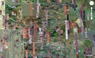
Here's an aerial photo showing the state boundaries. You should be able to quickly notice patterns of color and texture as well as drainage patterns (rivers):

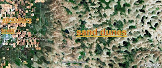
Zooming in on the NW part of Nebraska, where the dunes are located, notice the quilted pattern of the dunes, the choppy pattern of the adjacent agriculture use and the river in the lower left:

A bit closer:

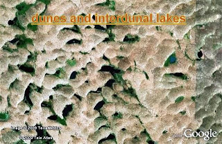
Closer yet, showing the beautifully intricate pattern of dunes and interdunal lakes.

Jennifer and I visited this area awhile back and we often remember it as one of our top nature exploration trips. The vastness of the dunes and the great number of lakes made for some all-to-ourselves birding and hiking. We saw a great number and variety of waterfowl and a number of upland gamebirds. Here's an on-the-ground pic from Valentine National Wildlife Refuge:

No comments:
Post a Comment
We love to hear from our readers! Please share your thoughts.